
Access to geospatial maps and data is essential for a wide range of purposes including urban planning and infrastructure development. Alongside public organisations, private institutes can also avail of the data provided by the Dubai government. To extract the data from the government, users are required to submit an application to the government of Dubai.
Here is how to apply for geospatial maps and data in Dubai.
Steps to Apply for Geospatial Maps and Data in Dubai
The geospatial maps and data are provided by different institutions including; Union Atlas, 1MAP, Environmental Geospatial Platform and UAE Data Portal.
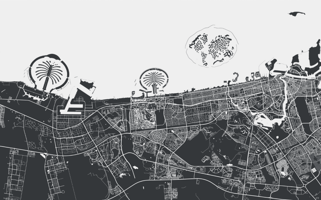
The data provided is from 1971 to 2021 reflecting the journey of the nation from the beginning. The geospatial maps and data can be used for multiple purposes in the real estate industry.

The prime example of data usage is for real estate infrastructure development. Moreover, if you are planning to invest in new residential projects in Dubai, you can check its location and neighbouring areas through the geospatial map.
Following are the steps to apply for geospatial maps and data in Dubai.
- Log in to ‘Dubai Municipality’
- Navigate to the Geospatial Maps and Data
- Dully fill in the required information and submit documents (mentioned below)
- Wait for the application to be approved
- If approved, download the map and data from the Municipality’s website
Aside from a geospatial map, you can also submit a map application with DLD in Dubai.
Documents Required
To obtain geospatial maps and data from the Dubai Municipality, a plan or coordinates of the geographical area is required, if applicable.
Service Fee
The geospatial maps and data extraction service is free of cost for all users.
Terms and Conditions to Apply for Geospatial Maps and Data
It is necessary to cater to the following terms and conditions to submit Dubai geospatial maps and data applications.
- An official work email is necessary when registering for the service.
- When applying, the reason for extracting information should be clearly mentioned and related to the work.
- Any extracted data or map can not be published anywhere, without the permission of Dubai Municipality.
- Data and maps extracted should not be shared with any third party without the permission of Dubai Municipality.
FAQs
What are the fees to submit application for geospatial maps and data in Dubai?
The service to extract geospatial data is free of cost.
Who can apply for geospatial maps and data in Dubai?
Public and private organisations can request geospatial data, but it is necessary to mention the reason for data extraction that should be work-related only.
Who provides geospatial data in Dubai?
Union Atlas, 1MAP, Environmental Geospatial Platform and UAE Data Portal can provide geospatial data in Dubai. You can submit a data extraction application through Dubai Municipality.
This was all about Dubai geospatial maps and data application process. The geospatial map and data reflect the incredible journey of the Emirate from the beginning. The maps reflect the rapid real estate development in Dubai, offering lucrative investment opportunities for investors. If you are also interested in availing of the high returns, browse through these properties for sale in Dubai and find the desired option to proceed with your investment.
Besides, here are some ways to begin your Dubai real estate investment that can help you in the process.
Stay tuned to dubizzle’s property blog for more information on real estate in Dubai.
